Kenilworth Heritage Trail
Welcome to Kenilworth, a place most definitely worth your time…. Step into our monumental story amongst the noble ruins of Kenilworth Castle. Lose yourself in the rolling greenery of Abbey Fields, or venture just a little further into beautiful countryside alive with nature. Spend a day uncovering the rich threads of our history, browse intriguing shops or simply kick back over some fabulous food & drink.
Kenilworth IS heritage, its name synonymous with history and stories. But this is a story worth telling, a story that includes monumental occurrences, triumphs as well as tragedies and an insight into everyday life, all weaved into the very stones of this town. So join us for an easy stroll to explore the highlights!
The walk is around 3.5 miles and takes approximately 2.5 hours (not including a visit to the Castle).The route is mostly on roads and paths (although can be muddy around the castle) and just the ticket to spend some quality time absorbed in the past.
War Memorial
Before you, the land rolls down into Abbey Fields, a landscape shaped by a glacial lake and the eroding action of the Finham Brook. The far slope would probably have held settlements in Roman and Saxon times but Kenilworth was just a tiny hamlet at the time of the Domesday Book. It was recorded as Chinewrde, pronounced Kinny-worth (the farm of Cynehild).
The War Memorial was dedicated in 1922 and updated in 1951 & 2018 to reflect those fallen in the two World Wars and the Korean War. Turn left and continue down Forrest Road to the Junction.
WW2 & The Borrowell
Staying on a war footing, the mound to your right was a WW2 air raid shelter (one of at least sixteen dug in Kenilworth in 1939). Now sealed up, it would have accommodated 50 people in a space 30 feet long and 7 feet high. Cross the road.
A short detour left along Borrowell lane lies the Borrowell, a water source dating to at least 1580. The current well is 18th century and was moved back 8 feet in 1872 to accommodate the road. Amazingly, drinkable water still flowed up to the 1960s! Return Northwest past the crossing. Turn left at post box onto small lane and bear right to reach the woodland at the end. Stay on higher path and on leaving woods turn right onto track leading to Castle car park.
Kenilworth Castle
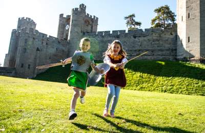
Today a romantic ruin, the Castle has a long and intriguingly royal history. Built in 1120 by Geoffrey de Clinton it became a royal possession and hosted luminaries like King John, Simon de Montfort, John of Gaunt, Henry V and Elizabeth I. Several owners enlarged and fortified the Castle and also flooded the land in front of you to create the mere and further enhance the formidable defences. Later additions included the “Pleasance” – a banqueting retreat across the mere and an 800-acre hunting forest. The castle in all its splendour was immortalised by Sir Walter Scott in his novel “Kenilworth”. You can visit the Castle at this point. Afterwards take the lower path behind the ticket office and follow the path around the Castle walls.
The Siege of 1622
The castle was increasingly fortified throughout the 12th -13th centuries, particularly by King John, who built the outer curtain wall and towers. In 1265 after the death of the rebel baron Simon de Montfort, the garrison commander refused to surrender the Castle to the King. In response Henry III laid siege to the Castle for almost six months in 1266. Despite the bombardment by catapults the powerful sandstone walls and defences held, with only disease and starvation eventually forcing the garrison to surrender. Henry enforced the Dictum of Kenilworth, a peace treaty that required the rebels to pay heavy fines. Continue clockwise to the junction with the moat path.
Elizabeth I and Robert Dudley
The castle is famous for the “romance” between Elizabeth I and Robert Dudley. Elizabeth granted him the castle in 1563 and keen to impress, Dudley embarked on an ambitious refurbishment; including the Gatehouse, a hunting forest and an entire wing and gardens for her sole use. Dudley spared no expense for Elizabeth’s visit in 1575 with lavish pageants, hunts and fireworks over the mere. The castle was occupied by parliamentarians during the civil war and its defences broken, with much of stone re-used elsewhere in Kenilworth. Take the moat path, cross the road (carefully), turn right at the old houses at Castle Green and continue ahead.
Castle Hill
The modern triangle of land, ‘the Godcake’ (named for the triangular cake) sits astride an ancient drovers’ route. Kenilworth’s traditional industries concerned the by-products of animals and in the 19th century 15 of 22 cottages in New Row housed horn comb workshops! The thatched cottages of Little Virginia are oft cited as the spot Sir Walter Raleigh planted the first potato in England. Sadly, the current cottages only date from 17th century and the area was likely stonemasons workshops in Raleigh’s time. Still, one cottage does feature a letter “R” on its wall – a remnant of Robert Dudley’s Castle. Continue uphill and cross to the southern side.
High Street
Named for being on high ground above the Abbey of St Mary, this road was the main route to Coventry. On your right is “the Pound” where stray animals were locked up until claimed (also an air raid warden’s post in WWII). The medieval marketplace was sited where the road widens, overlooked by the 16th century Virgins and Castle Inn. The site may have originally housed an almonry for the Abbey, but by 1575 it was known as the Two Virgins and the Virgins & Castle by 1852. Kenilworth’s best preserved WW2 shelter lies around the corner on Bridge Street. Continue ahead and follow New Street onto the Coventry Road. Pass footpath and take the gate on left.
Parliament Piece
An enigma chock full of myths! There is no evidence for Henry III holding parliament here during the siege (the Abbey being a more likely venue – with a roof!), and there is also little evidence of parliamentary troops camping here during the Civil War.
We can say that the land was donated by Miss Helen Martin (Kenilworth resident and generous benefactor to the University of Warwick), and the area is today managed as a traditional hay meadow. Cross Coventry Road and turn right onto Water Tower Lane.
Windmills & Watermills
The 1885 water tower to your right was originally an 18th century windmill (one of four in Kenilworth). Continue down Tainters Hill. At Manor Road turn left, cross the bridge and right onto the path by the Brook.
There were also watermills at seven possible sites along the Brook, including the Woodmill beyond the modern allotments. This section of the Brook was channelled to create a mill race (the sluice south of the bridge can still be seen). Continue along
the Brook to Bridge Street and under the bridge. The 18th century Townpool Bridge is marked with flood heights on its upstream side, including a 3.3m one in 1834! Take the tree- lined path towards the church.
St. Nicholas Church
Dating from 1291 this church stood alongside and outlasted the Abbey. The West Door is an interesting mix of Norman stones from the Abbey in a renaissance frame. On her visit in 1575 Elizabeth I attended two services here so it’s possible the door was part of Dudley’s efforts to impress. The church was damaged by lodging troops in the civil war and was remodelled in the 18th century (but lost its spire to lightning in 1858) and by 1885 the churchyard had grown to partially cover the ruined nave and cloister of the Abbey. With your back to church door, walk ahead on the unpaved path to reach the gatehouse.
Abbey Ruins
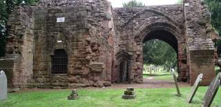
The Augustinian priory of St Mary the Virgin was founded in 1119 and raised to an Abbey in 1447. Extending to the modern tennis courts it was an impressive site that owned all the land of Abbey fields as well as mills, orchards and other property. During the siege of 1266 the prior had to put all this at the disposal of the King which nearly bankrupted the Priory. Dissolved in 1538 it was stripped of its wealth and left to ruin. The 14th century gatehouse was the main entrance to the Abbey but there are more remnants throughout and beyond the churchyard (look out for the plaques). Head south past the Swimming Pool (originally built as lido in 1896), up the hill and on to Abbey End.
Abbey End
On 21st November 1940 around 2:20am two 500kg land-mines, dropped Allotments from a Heinkel III, landed on the town. The first caused little damage but the second hit the crowded buildings of Abbey End. 25 died and more than 70 were injured in the explosion that levelled the area. The Globe Hotel was damaged but 60 of its guests survived. A memorial, on the site of the Globe records the names of the deceased.
The Clock Tower was unveiled in 1906. Installed by GM Turner in memory of his wife, it lost its “crown” to the landmine but was restored in 1974. Continue down Warwick Road to junction with Station Road.
Kings Arms Inn
This former coaching inn (now Zizzi) dates from 1563, and it famously hosted the novelist Sir Walter Scott in 1815. The building was actually demolished in 1986 and the façade completely rebuilt. The sandstone building behind it (on Station Road) is also a façade, this time of Kenilworth’s original station that was dismantled and moved to this spot in 1883. Talisman square (a short walk south) was the site of the 19th century Tannery. At its height, during the Great War it produced 1600 leather hides a week before demolition in 1963. Retrace your steps to reach Abbey End.
Download a PDF of the Kenilworth Heritage Trail
Discover more of Shakespeare's England
Things to Do
There's so much to see and do in Shakespeare's England!
Stay
Amazing accommodation to suit all budgets and tastes.
Food & Drink
Find something truly tempting to tuck into.
What's On
Explore a variety of fantastic events.
Follow us on Instagram


